|
|
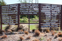
Lots of activities are available in this part of Southland. Just look at the board! |
|
|
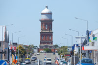
A most famous landmark in Invercargill - the Watertower. Here viewed looking up Leet Street. |
|
|
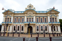
Invercargill Town Hall: a fine and tastefully decorated example of Victorian architecture. |
|
|
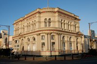
The old Bank of New South Wales building - an unexpected sight in Invercargill |
|
|
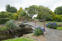
Otepuni Gardens, flowers and a bridge over the Otepuni River that runs through it |
|
|
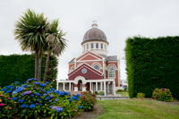
Another view of the Otepuni Gardens with sundial in the foreground and St Mary's Basilica in the background |
|
|
St Mary's Basilica framed by some of the flora in the Otepuni Gardens |
|
|
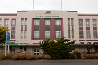
The old Post Office building reassigned as serviced rental apartments |
|
|
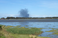
Whilst out at Bushy Point I noticed this dark cloud on the horizon. Here's the cause. |
|
|
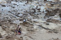
The "Ship's Graveyard" near Bluff with the town and hilly peninsula in the distance. Wooden ships were scuttled here and left to rot. Wrecks of five vessels are visible in this image |
|
|
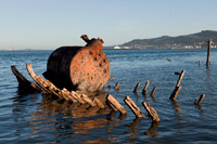
The wreck of the steamer "Savaii". All that remains are the ribs and the rusting iron boiler |
|
|
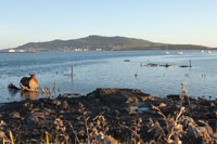
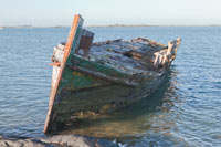
Another vessel left to the elements |
|
|
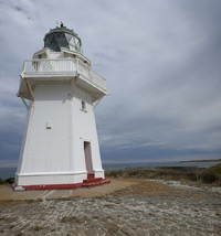
Waipapa Lighthouse. Built in 1884 after the passenger ship, Tararua, ran aground on the reef with the loss of 131 lives; the worst civilian naval disaster in New Zealand's history. |
|
|
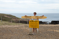
Slope Point, the most southerly point on the South Island. A view of the coastline at Slope Point. |
|
|
Curio Bay and the petrified forest that is revealed at low tide. A tree in close-up. |
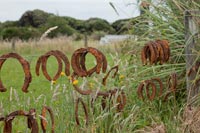 |
A lot of rusty horseshoes were on this fence at Tokanui. Must be a very lucky part of the world! |
-tn.jpg)